In the quiet coastal village of Barangay Bogtong, located on the island of Busuanga in Palawan — the Philippines last ecological frontier — the rhythm of life is intertwined with the tide.
For the over 1,200 residents of Bogtong, the green belt of mangrove forests is more than just scenery; it is their "bioshield," their nursery, and their supermarket.
Following the catastrophic impact of Typhoon Haiyan in 2013, which left a trail of damaged ecosystems, the community realized that their survival depended on the health of these salt-tolerant trees.
Today, with the support of the GEF/UNEP/UNOPS Implementing the Strategic Action Programme for the South China Sea and Gulf of Thailand (SCS SAP), Bogtong has emerged as a modest beacon of community-led restoration.
In a joint effort with the Tagbanua indigenous community on adjacent Calauit Island and the local government, residents planted 30,000 mangrove seedlings to fortify the Sagrada-Bogtong-Concepcion Marine Protected Area (MPA). This MPA is a cornerstone of the Calamianes Islands' biodiversity, protecting critical fisheries and wildlife habitats including dugongs which are classified as critically endangered in the Philippines.
The architecture of a coastal wetland
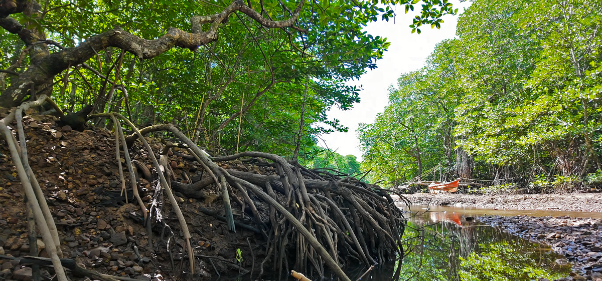
Mangrove areas are a unique classification of coastal or tidal wetlands, situated at the muddy interface between land and sea. These ecosystems thrive in brackish waters — a mix of fresh and salt water, often found at the mouths of rivers where salt-tolerant trees like the Rhizophora (Bakau) or Bruguiera (Pototan) form dense, protective canopies in Bogtong.
Their intricate, web-like root systems act as a natural filtration system, trapping sediment and nutrients that would otherwise suffocate nearby coral reefs. Beyond filtration, these "blue carbon" sinks are global climate heroes, sequestering up to five times more carbon than terrestrial forests by locking it into the anaerobic soils beneath their roots.
Read the full feature story on GEF IW:LEARN.


